History of the Mark Twain Neighborhood Part I
After a 22-year break due to WWI and the Great Depression, the New Mexico State Fair re-opened in October 1938, “way out” on East Central Ave. and has been held there every year since. At that time the area that would become Mark Twain neighborhood was an empty space, not even subdivided, though development was underway farther east.

In 1943, when San Pedro Drive was the far east limit of service by Albuquerque Bus Company, Albuquerque’s metro area to the west ended just over the Rio Grande past Atrisco.

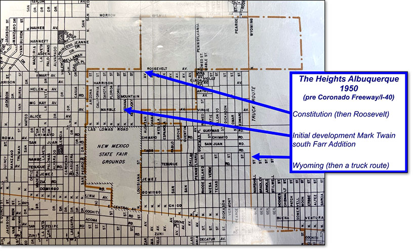
By 1950 the south side of Mark Twain, known as the Frederick Farr Addition, had streets from Las Lomas Road (now Lomas Blvd) to Roosevelt Ave. (now Constitution). Summer St. was then named Harrison. Development to the northeast stopped at Wyoming, a designated “Truck Route”.
1950 – 1954
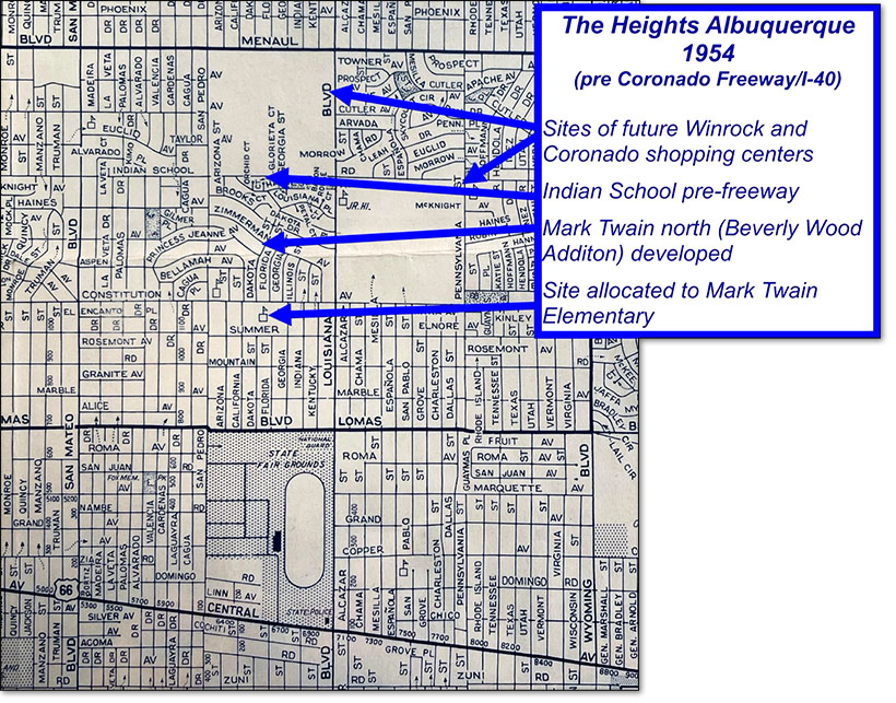
The pace of eastward expansion and building was extraordinary. By 1954 streets followed by housing were on the march north and east of Mark Twain. Street names were finalized as they are today and the site of Mark Twain Elementary was established. Home building started in the Beverly Wood Addition north of Constitution in the late ‘40’s and homes there were completed from San Pedro to Louisiana by the mid 1950’s. By then builders like Swearingen, Bellamah and Sproul, among others, had started building in the Frederick A. Farr Addition south of Constitution and north of Las Lomas.


It was not all smoothing sailing (building) for the neighborhood. The City struggled with expanding water supply to meet the new demand.
By 1954 streets, followed by housing, were on the march north and east and within Mark Twain. Street names were finalized as they are today and the site of Mark Twain Elementary was established.

1954 - 1962
Mark Twain soon came into use as a name to describe the neighborhood area both north and south of Constitution.
